Patrick McConnell
About Archive Also on Micro.blog
  • East Jewett Range

    In the Catskill Mountains of New York, there are a handful of lists iterating the 100 highest peaks of the region and somewhere in the bottom third of that list is a peak known as East Jewett Range. Until recently this peak was on private land and climbing it required contacting the owner and gaining their blessing. At some point in the last few years the NY City Department of Environmental Protection acquired the land around this peak and it is now publicly accessible.

    Scribner Hollow Unit Map

    The DEP own many parcels of land throughout the Catskills acquired to help protect the watershed that provides New York City with drinking water. DEP allows for many public usages of the land and one of them is hiking so if you’ve wanted to visit this peak it’s now publicly accessible.

    The map above shows the “parking area” at the end of Beecher Road as a star. I quote the parking area designation because the cul de sac at the end of Beecher Road is posted with no parking signs.

    No Parking Sign

    As I was visiting in June I assumed I wouldn’t be blocking any snowplows so I pulled off the pavement and parked my car.

    The land has been logged and is riddled with logging roads. A few online maps will show some of these roads as unmaintained roads or trails. If you’re not familiar with logging roads don’t expect much more than a heavily rutted cleared path through the woods about 10-12 feet wide. You couldn’t drive on most of these roads unless you were in a skid-steer as the loggers were.  In fact branching out from the parking area are at least 3-4 of these roads. More than one will probably get you on the way to the summit but the most prominent, which I took, is much wider than the others and continues in the general direction of Beecher Road to the west.

    Starting road.

    When I was doing this hike, it had just rained over two inches in the past 24 hours so the trail was very wet but nothing that couldn’t be bypassed. It was early June so the brambles were just starting to fill in making for some thorny areas. 

    As the crow flies, it’s approximately a half mile to the summit but unless you abandon the roads entirely and climb hand over foot you will most likely walk 1.5-2 miles finding a more accessible route to the peak.

    The loggers had the same goal as a hiker, for the most part. They wanted to get to the lumber at the top of the mountain so they may have wandered all over the mountain while cutting their roads but eventually they got pretty close to the summit. If you are patient and follow the roads they will follow a switchback type pattern following the elevation contours for a bit then climbing a step sometimes 100 feet or more in elevation before they again follow the contours. More than once I didn’t trust the road would turn and climb so I headed off into the woods, off the road, and climbed only to intersect another road segment. So my advice is if you want to take the path of least resistance, trust the process and follow the roads as they swipe back and forth across the mountain.

    At no point is the climb very difficult but there are several points where you will encounter cliff faces sometimes 20-30 feet in height. The picture below probably doesn’t do the height justice.

    Cliff Face

    Since the loggers couldn’t drive the skid-steer up the rock walls the roads will eventually show you a way around or you can just follow along the cliff until a path appears.

    While I wasn’t quite patient enough on the way up to follow the roads the whole way, one could probably get to within 100 feet of elevation of the summit by way of the roads. Keep in mind these “roads” are just places where the trees were cut and a piece of heavy equipment could get through. It’s not a carriage road or some neglected thoroughfare you could still drive along in the right vehicle. It’s rough. It has ruts. It’s full of downed limbs, potholes and brambles. In another decade these roads will fade into the forest and only the person really looking will see where they were.

    It appears the easiest way to make the final ascent to the summit is via the col between the true summit and another bump on the mountain top. On most maps this col is noted as the mountains summit but it’s clear from the topographic map that both humps on the summit attain more height. The actual high point is on the larger of the two bumps. It’s on this large plateau that there is a largely untouched remnant of the original pine forest including some older growth large trees.

    Forest

    Just before these thicker older trees is a clearing with some stones not quite in a fire pit and another forming a low wall. It’s unclear if this was just some random stone work or if there may have been a structure here at some point?

    clearing in the woods

    I wandered most of the summit plateau and didn’t see any marker or cairn indicating the high point. The sun did manage to break through the overcast skies to fall on this one larger rock at what appears to be a high point so I settled on this as the summit.

    Summit rock.

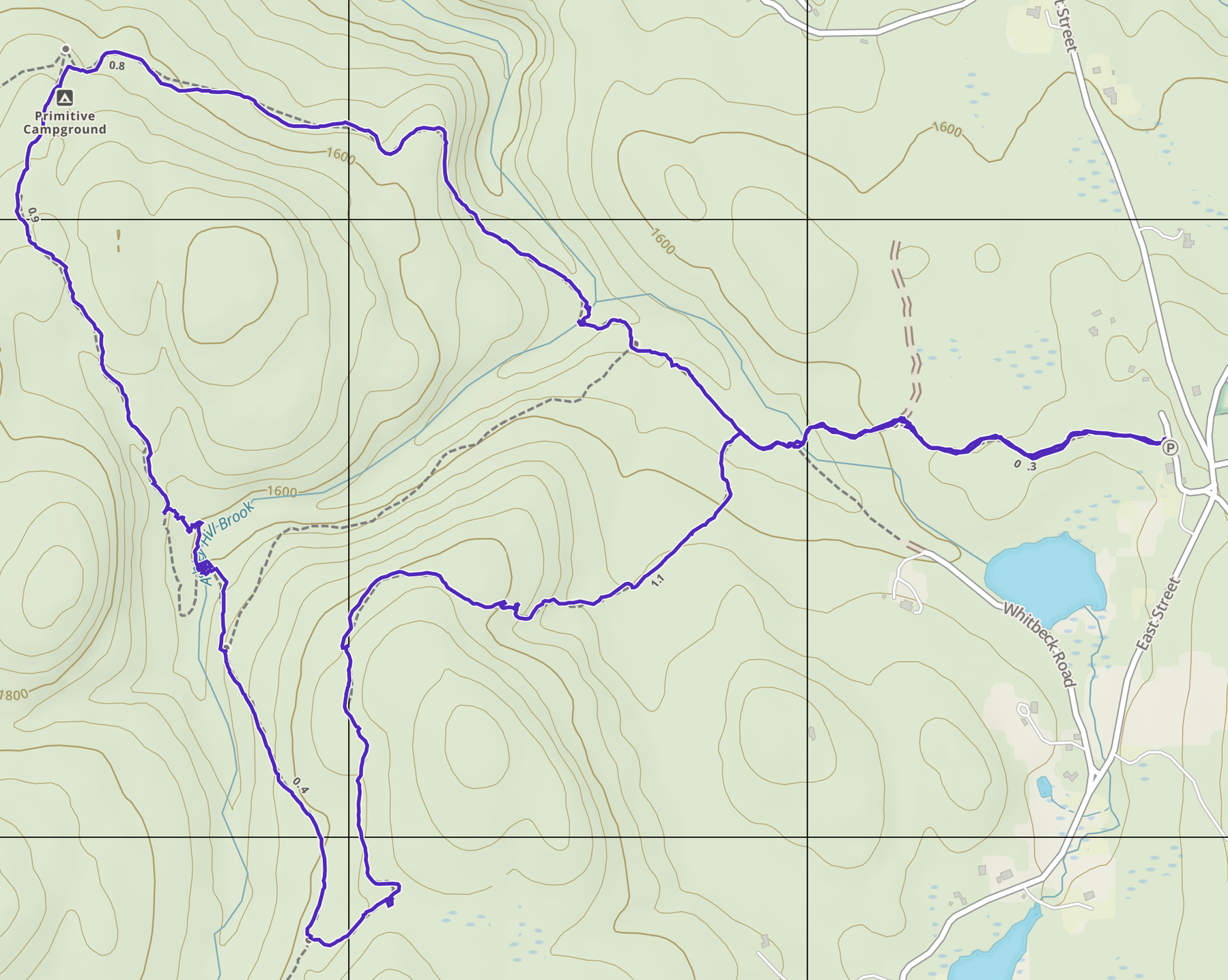
    Looking at my GPS track, you can see my impatience with following the roads. The path to the east (right side) is the ascent. After the peak on the way back down I took care to more closely followed the road, descending to the col and taking the roads where possible. This is probably a better plan of attack.

    The woods on this mountain are very wild in spite of the loggers disturbances and to be fair I saw no litter or other junk. There was more sign of wildlife on this hike than I can recall on any other. Virtually any time you looked at the forest floor there was some bear, deer or other unidentified scat. My dog was constantly off the track wandering after scents. We did see a large deer and there were some signs of recent bear activity near the summit where a bear had clawed the bark off a tree probably looking for insects or grubs. This tree damage looked very fresh but we didn’t see any other signs of the culprit.

    Bear ravaged tree.I spent about three hours walking a bit over 4 miles up and back. The elevation gain was about 1,000 feet. As with any bushwhack you can tackle this hike any way you choose. The woods are never too dense that you can’t just make your own way. The roads will eventually get you to the top if you trust the process of tracing the elevation contours back and forth across the mountain. 

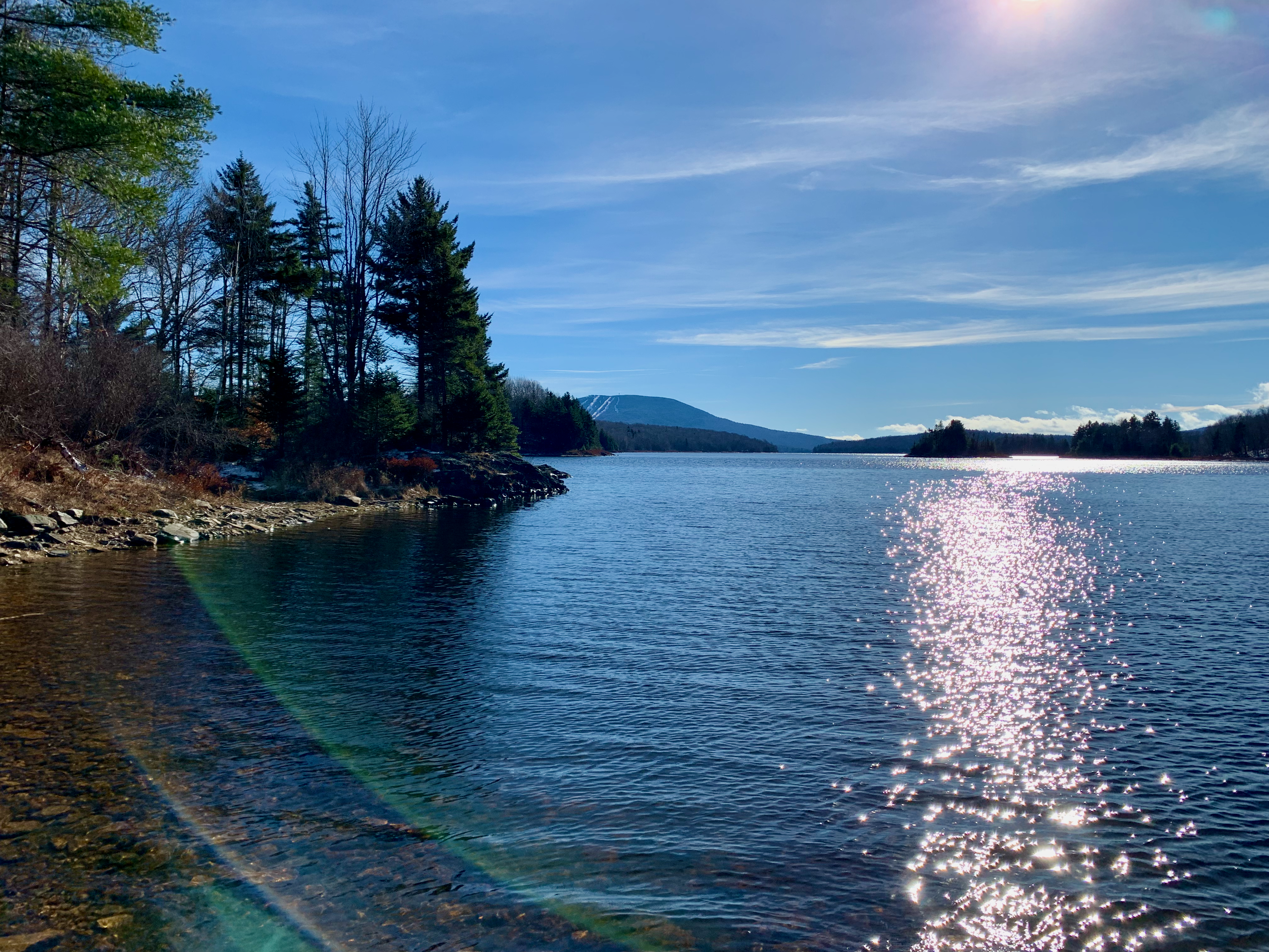
    There were no views to speak of but it is apparent that if you were here when the leaves are off the trees you could get a good look at the Blackhead Range to the north or Hunter and Rusk to the south. With our cold spring this year the thorns were only starting to become a bother but it’s clear in high summer it will be a scratchy trip.  

    I’m certain as word of this peak now being publicly accessible spreads a herd path will develop but for now it’s a decent bushwhack for people comfortable with navigating a bit. The philosophy of just going up until you reach the top will work but with all the roads and cliff faces it’s easy to get turned around. Use a map and compass or GPS and you won’t have any trouble. 

    → 2:23 PM, Jun 2
  • Filling in the Gaps

    One of the perks of self-employment, probably the biggest one, is being able to use your time as you see fit. So feeling like I needed a mental health day in the mountains I took a nice long hike on Thursday.

    The temperature started at around 45º but it was going to warm up with sunny skies. It did eventually reach 65º.  I was probably underdressed for the start in shorts and a shirt but I always say you need to dress for the weather you want. I’m not foolish so I do carry extra layers in case that doesn’t work out.

    One of the ways I decide to where to hike is looking at my past GPS tracks and look for missing segments. This is just one handy feature of having OCD. I have long had a gap in the Overlook Trail between Overlook Mountain and the Devils Kitchen. I’ve done this trail from both ends many times but not hiked the whole distance between the two trailheads with a GPS. Yes, I did walk the trail from Devils Kitchen to the Fire Tower on Overlook many years ago pre-GPS but that doesn’t count for GPS enabled OCD. I decided to rectify this glaring omission.

    IMG 2041

    I started this walk from the Northeast end at the trailhead in the Platte Cove Preserve. In peak season it’s difficult, if not impossible, to park at the preserve due to the waterfalls accessible via a few short hikes. On this weekday spring morning I was only the second car here.

    IMG 2045

    Having visited the falls here several times I made good time heading through the preserve to where it connects to the the Devils Path heading towards the Devils Kitchen Lean-to. It was one of those days where you seem to have boundless energy and I made good time.

    IMG 2049

    At the junction to the Devils Path is the first of many old bluestone quarries to be seen along this route. In the 19th century much of this area was dedicated to extracting bluestone and supplying it to local cities for their sidewalks and other use. Today the quarries are mostly used by rock stacking and chair building aficionados. 

    IMG 2051

    It’s interesting to poke around these areas to see how widespread the quarry work was. I suspect many hikers walk past much of this without even noticing. Nature has a way of reclaiming these areas and unlike other quarries that tend to leave huge holes in the ground, these are more surface level and little remains to be seen but stack of rock and a few larger pieces of stone that look ready for market but never made it out of the woods.

    IMG 2059

    A short distance from where the preserve trails join the Devils Path is the Devils Kitchen lean-to. This is great camping spot being situated right on a creek. The lean-to has seen better days and the lean in this case is from the structure tilting to the right quite a bit.

    IMG 2063

    Further along the trail is a larger quarry. It has some nice views out to the Hudson River. IMG 2065

    This quarry is on a spur trail off the Devils Path that parallels the trail for about a half mile. There was extensive work done here long ago and it’s interesting to see and imagine all the work happening in these now quiet woods. While you may feel a long way from civilization at this point, the Devils Path was originally a road so the quarry would have been well situated to get the stone to market,.

    IMG 2070

    This section of trail is also a designated bike trail and for long stretches the grade is gentle and it’s not your typical Catskill trail that reminds you more of a stream bed than trail. A mile or two after the quarry spur trail is the trail to Echo Lake. The area around the lake is a bit too popular and any time I’ve visited it was a bit trampled over. I decided to skip it for today. 

    In another mile or so the trail begins to climb but not too aggressively. The trail skirts the edges of Overlook mountain winding around to the area most often accessed via the southwestern trailhead on Meads Road across from the KTD Monestary. The Monestary itself is worth visiting if you’re passing through that end of the woods. 

    IMG 2077

    As you wind around and climb to the peak of Overlook Mountain you can begin to make out the tower above the trees (yes, it’s in that picture above.) This area is also notorious for rattlesnakes but I didn’t see any on this day in spite of the warm sun that they normally enjoy. Yes, the Catskills (and parts of the Adirondacks) do have a rattlesnake population.

    IMG 2078

    I’ve been to this tower many times and while the view from the tower is great I always enjoy the stone ledge views that most certainly led to this mountain getting its name. The view above is of Ashokan Reservoir with the village of Woodstock nestled in the trees as well.

    IMG 2088

    These rock ledges in the Catskills have long been popular and many prior visitors have carved their names into the rock. Here are samples dating back to 1892 and there are many earlier carvings as well. 

    IMG 2090

    The tower was looking sharp against the bright blue sky and people were picnicking at the base on this near perfect day. 

    IMG 2100

    Heading back I detoured briefly into the ruins just below the peak. The ruins were to be a hotel but were never fully completed. They replaced earlier iterations of the hotel that burned. Always fun to wander and a great spot for photos.

    IMG 2103

    On the return trip, just below the summit a spooked a deer who was probably drinking at the stream as it crossed the trail. The deer didn’t run off and probably wanted me to move along so it could get back to doing deer things. 

    The walk back was scenic but uneventful. It is one of those rare Catskill hikes where the terrain underfoot is mellow enough that you can glance off the trail. Evidence of more quarries are seen if you look. At one point I spotted what looked like a bluestone stair tread, a piece of stone about one foot by four feet. I then found several more similar stones just off the trail. It’s not clear if this was a remnant of a structure or materials that were going from the quarries to a building somewhere far off. Being stone they were as good as new and if I had the means I would have gladly carted them home and put them to use.

    Screenshot 2023 04 22 at 12 41 11

    This round trip on a perfect spring day covered 10.6 miles with a gentle ascent of over 1,400 feet. Now that section of trail is filled in. Time to find more gaps and get back out there.

    → 12:58 PM, Apr 22
  • A Few Miles in the Sun

    I’ve said in previous posts that many of my hikes are return visits to old familiar places. Sometimes it’s not about discovery it’s just about getting out. With that in mind, I got in a great hike today around the woods at North/South Lake

    I started the hike from the beginning of the Kaaterskill Rail trail knowing I just wanted to get in some miles in the woods and this would let me pad my walk without too much thinking. The snow has all but cleared out at the 2,000’ level though some of the north facing peaks had snow hanging on at what appeared to be around 3,000’.  This area around the lake and rail trail lies at about 2,000’ feet so the only remaining snow was in deep shaded pockets. It was nice to walk on mostly dry ground.

    When we last saw the old train depot it was covered in snow. Today it’s free of winters grasp and looking well.

    IMG 2017

    With much of the snow gone there was quite a bit of action in all the seasonal creeks and other waterways along the trail. The pictures won’t do it justice but if you spend any time in the woods you know how relaxing it is to spend a few minutes at these spots.

    IMG 2020

    IMG 2034

    The lake was reflecting the bright sunlight and it seems it’s time to apply the sunscreen again for the next 8 months.

    IMG 2036

    Not much new ground covered today but I did come across one interesting spot I’ve seen before that I don’t recall getting photos of. As this area is now largely a state campground and day use area there are many campsites, picnic spots and other facilities. One spot has several fire pits that appear to have been left to the elements in the woods. Not clear why these would not be cleared and used as any time I’ve visited in season the place is full.

    IMG 2028

    In this second shot there are at least 3 abandoned fire pits if you look hard enough.

    IMG 2030

    7.5 miles hiked and a whopping 336 feet of elevation gained. Much fresh air and sun was had.

    Screenshot 2023 04 09 at 18 11 53

    → 6:17 PM, Apr 9
  • Winters Last Gasp (hopefully)

    After 3 weeks of lingering cold symptoms (not covid but annoying regardless) I finally got out into the woods. It snowed a few inches last night at the house but I suspected the hills would have more and I was correct. I probably bit off more than I needed to so soon after not leaving the couch for a few weeks but I survived.

    The Mount Riga State Park is a Connecticut park right at the northwest corner where Massachusetts, New York and Connecticut come together. This hike would have me park my car (or more correctly “cah") in Mass., snowshoe through Conn. and summit in NY

    Since I was sure I was not in shape for a stressful trip I avoided the routes with a few steep climbs over peaks that I’ve done before and took the road trail. The road through the park is closed in the winter so it was a nice wide strip of fresh, heavy snow to trek though.

    IMG 1998

    The 2” of snow we got at home was 6-8” along the closed road and as I traveled up to elevation it was 10-12” This was a journey with no real destination. The goal was to just get out in the woods and I accomplished that.

    `IMG 2002

    IMG 2003IMG 2007

    It’s not clear from the last photo but I turned around before the potential view because the clouds were in the process of settling on the peak so there would be no views today.

    Screenshot 2023 03 11 at 16 58 24

    About 6 miles of trail breaking through some moderate depth snow. This snow won’t last long as there was little in the surrounding areas at lower elevations and temperatures are rising, slowly week to week. The snow clinging to the trees was falling the entire trip and I am hopeful mud season starts soon enough, as bad as that sounds. This was a very pretty trip in the woods but I’m ready for spring.

    → 6:07 PM, Mar 11
  • Winter Hanging on in the Woods

    Had a break from work on Friday and the temps were hovering around 50º for a bit so I needed to get out in the woods. I didn’t have time for an all day trip so I headed back to the Pittsfield State Forest and its web of tangled ATV/Hiking trails. 

    The trails in this forest are accessed from several different trailheads so I figured I’d try a new approach. The first trailhead had private signs marking the road barrier. I had my doubts if that was a legit warning as the road is still on the map as a public right of way but since there is another trailhead about a mile away I decided to try that alternative.

    The official road ends at about 1,400’ of elevation and there was only a bit of old snow on the road as it entered the woods. The wind was picking up and the 50º temperature was not going to last.

    IMG 1988

    Due to this still being a “road” on smaps both sides had private property for about 3/4 mile before getting into the actual state land. There was quite a bit of evidence of logging including run down trucks, equipment and rough barn buildings. 

    IMG 1989

    After entering the state forest section the snow was deeper and there was some ice on the trail. This trail is also for ATV/Snowmobiles so it is basically a rutted track in spots sometimes 5 feet or more wide and a few feet deep. This does not give the meltwater anywhere to go so it freezes into a bobsled run in spots. Nothing that can’t be walked around and the snow/ice was melting quickly.

    IMG 1990

    There are so many intersecting trails for all sorts of purposes that you need to keep an eye on the map or GPS. You never get so far off into the wilderness that you will be lost for long but you could easily come out of the woods miles from where you parked.

    I spotted this tiny birdhouse like item hanging from a tree at the junction to the Tower Mountain trail. The whole thing might be 3 inches tall. No clue what it is. You always see interesting things in the woods if you stop and look.

    IMG 1993

    Tower Mountain is named for the former firetower that once stood on its peak. The tower is long gone but a sign remains to mark the spot.

    IMG 1994

    Upon reaching the summit of Tower Mountain, the wind was really picking up and the temperature had dropped from the elevation gain as well as the front apparently moving in. I elected to not go much further so I picked a trail that would circle back to the car via the Taconic Crest Trail. This trail intersects the various ATV tracks all through the woods up here but is in better shape than the machine trafficked trails due to it being lightly used and only by hikers. The Taconic Crest Trail straddles the border between NY/VT & MA for over 30 miles along the ridge of the Taconic range. I’ve walked most of this trail in bits and pieces. It’s a very nice quiet trail that visits some interesting spots. One day it would be nice to make a weekend trip of the entire trail.

    IMG 1995

    Covered just under 3.5 miles with 630 feet of climbing. While micro-spikes would have been helpful in spots there was nothing that could not be avoided. The biggest issue besides the wind gusts was the rate of melting snow causing it be very wet and some cold feet.

    Screenshot 2023 02 12 at 6 38 17 PM

    After several hikes in this area, I’ve only scratched the surface what’s here. I’ll be back again soon.

    → 7:49 PM, Feb 12
  • A Influx of Vitamin D

    Saturday I wanted to do something a bit more challenging that my recent local hikes but not too technical. On days like these I tend to revisit a favorite hike so I decided to hike Hunter Mountain from Sprucetown Road. I’ve done this hike dozens of time so I told myself I’ll just walk up until I feel like turning around. I don’t need yet another picture of the fire tower on top of the mountain.

    IMG 1978

    There was some snow on the trail but it had been heavily trafficked recently so snowshoes were not needed. I slipped on my spikes to ensure some good traction and headed out. I did strap the snowshoes to my pack in case I needed them higher up.

    IMG 1980

    It wasn’t too cold but most importantly the sun finally made an appearance.

    IMG 1979

    Can’t recall the last hike I was able to see my shadow.

    I walked the old road/horse trail towards the tower at a steady pace, relaxed that I had no real goal other than to just be out in the woods for the afternoon.  

    IMG 1981

    After a few miles of walking I reached the spring just below the John Robb lean-to and as usual it was still pumping out water into the old barrel. This must be one of the most reliable springs in the Catskills. I ventured past the former site of the lean-to and the trail to the newer one. The new one is in a far better spot a few yards of the trail but there are still some views looking back towards Rusk Mountain from the old lean-to site.

    IMG 1984

    I’m now at the age where I’be been hiking these mountains so long I can remember back when there were views in many spots that are now blocked from tree growth.

    I reached the turn off to the Colonels Chair, a trail I have never bothered to hike and after today I can still say I’ve never hiked that trail. Normally when I head out to Hunter I want to get to the top or complete the full loop and I don’t want to invest the 2 plus miles out and back to visit the ski slopes that launch from Colonels Chair. 

    I did start out briefly on the spur to the slopes but after it descended a few hundred feet I decided I really didn’t want to climb the amount that would be required on the return trip. I can now say I’ve hiked about a quarter mile of that trail and one day I’ll finish it in my quest to fill in the map.

    After the quick aborted trip down the spur I decided it would be ok to just head down to the car, so I did.

    IMG 1982

    It’s always surprising how steadily this trail climbs often taking more out of you than you recall from the last visit. In that case the way down is always far quicker and I was back to the car in about an hour covering over 3 miles. Not as quick as a few of the backcountry skiers I encountered but respectable for foot travel.

    Screenshot 2023 01 31 at 4 10 44 PM

    A around 6 miles covered with 1,500+ feet of climbing. But most importantly I saw the sun.

    → 5:16 PM, Jan 31
  • A Twofer

    On Saturday I continued the quest to explore any and all local wilderness areas. I discovered there was a fire tower in a forest near Rhinebeck and being a big fan of fire towers I put this on the agenda. Nearby were a few other parks/preserves so I kept my options open to visit another spot, time permitting.

    About 30 minutes from me is Ferncliff Forest and my maps showed a fire tower and several shelters for camping there. This looked like an interesting place to explore on yet another dreary gray January day.

    IMG 1939

    A short walk from the parking area leads to a small lake/pond with 3 shelters. According to the website these shelters are all free to use but a reservation is needed. If you’re looking for a quick walk to an overnight camp spot these might be helpful. The forest is not far off the Empire State Trail so these might also be useful for those on a bike tour. I’ve often thought of riding down to NYC or Long Island to visit friends and family so maybe these would come in handy one day.

    IMG 1940

    Next to another shelter, the beavers have been active and this was not the only spot showing signs of their work.

    IMG 1946

    Another pond appears to be forming further along the trail due to the beaver dam blocking a stream.

    This forest allows mountain biking and it looks like bikers have taken that to heart. There are a lot of trails and they almost seem redundant in spots if you’re walking. There are trails right next to trails and some of the trails are clearly routed for single track fun, winding back and forth through the woods in ways you might not create a trail for walking.

    Not a problem as the trails are all in good shape but it does create the need to carry a map or have your GPS handy as there are many trails and it’s easy to get confused. My GPS didn’t even show all the trails here and it appears the map provided on the web site does not either. You’re not likely to get very lost as the forest is surrounded by roads and not all that large that you would find yourself trapped in a wilderness survival situation.

    IMG 1941

    As I mentioned, there are several different shelters and they are even different styles. There are a few traditional NYS style lean-tos.

    IMG 1943

    There are also some other interesting shelter designs. This one looks like it would be great for cold weather camping but I’m not sure how much wood you would find nearby.

    IMG 1949

    After wandering the woods for a while I decided to seek out the tower I’d read about. It is situated in the middle of the forest on a high point as would befit a fire tower but it’s also quite a tall tower.

    IMG 1952

    That height gives you some great 360º views of the Catskills, Taconics and local farms. 

    IMG 1953

    IMG 1947

    As this is one of those local adventures you’re never far from civilization and on some of the trails you are actually right next to the road, in this case route 103/River Road. I only saw one car pass as I walked this stretch of trail for about a half mile so the road is lightly trafficked.

    It’s easy to create a few different routes through the forest and I ended up doing about 3.7 miles with a total ascent of 265 feet. If you’re looking for a low stress way to visit a fire tower and get some great views this is it.

    Screenshot 2023 01 23 at 4 58 36 PM

    After I got back to my car I removed my muddy boots and started to head home. I figured I would take a scenic route along the river. I returned to River Road which seemed to promise something interesting. I had traveled less than a mile when I came upon a sign for Poet’s Walk. I had seen this when pouring over my maps looking for targets to visit so I figured I would pull in for a look.

    It’s only about about a mile, one way, down to the river from the parking area so I put my muddy shoes back on and headed out. I was quickly greeted by a woman from Scenic Hudson who runs the park. They are looking for someone to be a gatekeeper, closing the gate after hours. It did sound like my kind of community service but it’s too far a drive for me to do that every day. It is a paying gig so if you happen to be local look them up.

    IMG 1966

    The trails here wander from open meadows with distant Catksill views to wooded paths crossing over a few streams.

    IMG 1962

    There are some nice examples of rustic architecture and furniture.

    IMG 1968

    I imagine this place gets very crowded in the warmer months where people can spend time just lounging about in the fields.

    IMG 1969

    There are a number of stream crossings on the woods trails. The recent wetness created some slippery footing in that classic Hudson River Valley mud/clay soil. Micro-spikes would have helped in spots. It was very slick.

    The trail basically creates a loop either way you go and eventually you end at the river overlooking the train tracks to the mighty Hudson and the Catskills beyond.

    IMG 1971

    At the location called “Summer House” there is a gazebo and some other seating. The other destination near the river on the trail is called “The Lookout” both are clearly marked and very close to each other. The Lookout sits on a hill and again there are a a few benches to sit on.

    This quick walk added about 2.4 miles with 170 of “climbing” 

    Screenshot 2023 01 23 at 5 21 37 PM

    Not a bad way to spend another gray Saturday. Always impressed with these preserves or little pockets of wilderness. They’re not always the same as climbing one of the high peaks but sometimes you get your wilderness in different ways. I’m glad these sorts of places are here. Thanks for people like Scenic Hudson for creating these resources.

    → 6:35 PM, Jan 23
  • Spring Runnoff in January

    In an effort to visit every “local” patch of nature I ventured to the Hannacroix Creek Preserve in New Baltimore on Saturday. I’m not very familiar with much on the other side of the river so this was a mission of exploration. The map showed a waterfall and I expected to see it flowing due to the recent rains. 

    IMG 1916

    The trail can be accessed from two locations, one on NYS route 144 and another just off the Main Street up Madison Avenue and situated next to a church retreat center. I chose to park at the later location.

    IMG 1917

    Upon entering the woods it is immediately apparent this was a well traveled road at some point. Stone walls and a few foundations are quickly spotted.

    IMG 1920

    One section of walkway is quickly reached in a low area. No danger of water today but a light dusting of snow on the smooth boards can be slippery.

    IMG 1918

    At the end of the more pronounced woods road a junction is reached at the Hannacroix Creek. The creek itself is not very exciting, your standard creek through the woods, but just off to your left is a small trail that leads to the waterfall noted on the map. The falls are not terribly high but still provide some scenic bang for their buck and were running well from the recent rains.

    IMG 1923

    No swimming signs are present every few yards but I expect they are often disregarded in the warmer months. This looks like one of those spots that is best visited in the off season to avoid the masses.

    Continuing back on the aptly named Paper Mill Trail you soon come to the namesake ruins of the Croswell-Parsons Paper Mill

     IMG 1926

    The rest of the trail wanders up and down a bit until you reach the other parking area along route 144. From there you can return via a slightly different route or cross the road to another short trail leading to the Hudson.

    Along the way to the river, more ruins are spotted including this chimney up on  a slight rise

    IMG 1927

    Another sight is this truss bridge constructed from recycled plastic. I guess this is better than letting the plastic not rot in landfills. It can resist rotting here on the trail and provide a way to cross the tidal stream.

    IMG 1929

    While we are not experiencing anything like a normal winter weather wise, it was still too cold to linger long at the rivers edge and there really isn’t much to see once you reach the river.

    IMG 1930

    Just a traditional New York winters day with gray upon gray. Snow might improve this scene if I’m being honest.

    IMG 1931

    I headed back to the car by way of a slightly different set of trails. My apps were all over the board with mileage for this one. The phone shows one thing and the watch another. This was about 3.5 miles give or take and only few hundred feet of climbing.  The screenshot below is from a new to me promising app called Footpath. I am a long time GaiaGPS user but they seem to be slow fixing things or adding new features since being acquired by Outside so I’m keeping my options open. If all else fails I still know how to use a map and compass.

    IMG 0184

    Heading out to a new local slice of wilderness is often a pleasant surprise and rarely disappoints. This is another such case. The scenery was pleasant and the walk was enough to get the blood pumping without straying too far from home.

    → 11:46 AM, Jan 16
  • Warmer is Not Always Better

    I can’t say I’ve been working on the Catskill 3500 list as I’ve been hiking the list peaks for over 30 years and I’m still not done. Let’s call it nibbling on the list. I sometimes get the idea to do something foolish like visit one of the peaks I’ve yet to summit. So today it being in the 50s at home I figured it was a good day to check off my 3rd of the winter peaks, Panther Mountain. Mistakes were made.

    I left home a bit late but my gps app said it was only 3 miles to the Panther Summit with about 1,600 of climbing. The numbers were off and really didn’t reflect the level of difficulty. Last week this area received over 24” of snow and most of that snow remains at elevation. The lower elevations are a slippery icy mess from all the traffic over the past holiday week. I saw more than one group of smart hikers turn back at the first of the steeper patches as they didn’t have proper footgear. 

    The first mile plus was either ice of well packed snow that only required microspikes to navigate. Still there were areas where footing was not great and my feet would often slip on the snow now warming enough to become soft slush. This would be a theme for the full trip.

    IMG 1895

    The first vantage point is the highly trafficked Giant Ledge but even before the ledges there are some good off season views at the Burroughs Range through the trees. The drop from the backside of slide down to Cornell is very obvious from this vantage point. I remember one of our death march hikes when we were younger and more foolish when we dropped off Slide into a deep snow drift on what would then need to be a one way trip down to Woodland Valley.

    IMG 1899

    There is a reason Giant Ledge is so frequently visited and its views like these. Very few locations let you see so many Catskill peaks in one panorama. The sun did break out later only improving the view.

    The path up to Giant ledge, while slippery, was fairly well packed and had not softened as much as the col to Panther or the Panther summit. I only started to descend a few yards off Giant Ledge before it became clear that snowshoes were more appropriate to avoid postholing every third step. Snowshoes are both a blessing and a curse as they allow you to float over some obstacles but their general unwieldy size often make them tricky to maneuver in tight spaces or the typical Catskill steep rock climbs.

    IMG 1896

    At this point I was regretting not bringing quite enough water or snacks a decision I would regret later. My late start was also becoming an issue made worse by the slow slippery travel. I met another hiker who called this a “technical day” and that sounds right to me.

    IMG 1907

    I didn’t recall much of a view from Panther on my past visits but I was able to get some shots through the trees. I wanted to reach the summit by 2:30PM in order to have 2 hours to get back to the car and I was already about 15 minutes behind schedule.

    News of the warming trend clearly not reached this elevation and I was wet, almost out of water and hungry. I drank most of my water, ate a Larabar and added another layer. What I could not do was linger as the sun would set in less than 2 hours and I figured that’s how long the trip down would take

    My feet were soaked through my “waterproof” boots and standing still for more than a minute would make this painfully obvious. Even catching my breath was not ideal at this point as I was wet and needed to get moving and warm again. So I began the walk down.

    At one point I tripped over my snowshoes one too many times and decided to take them off. I was too tired and they were not helping as much as I would like. I put the spikes back on an made better time. Yes I added a few post holes but I assure this trail was already cratered before I got there. Every step was twice as difficult as it would have been on a clear trail. It was a crapshoot if your foot would finish where you placed it. The ice, slush and soft snow made this portion of the hike an adventure.

    I made better time without the snowshoes but I’ve rarely felt this worn out with half of the hike still left to complete. Hopefully the snack, water and heading back down would warm me up and give the enough fuel to finish before dark. In the end, it did. It was not the most enjoyable trip down but once I warmed up it went ok.

    As I got down off the other side of Giant Ledge, on the way back to the car, I saw another hiker heading up. I assumed I would be the last person on the mountain today as the sun was only minutes from setting. I asked the hiker how far he was going and he said Panther. He clearly looked like he knew what he was doing and I enquired if he had lights and he pointed as some fancy led array of lights on his chest and mentioned he had just done the entire Burroughs range this morning. I remember when I was younger and stronger too. 

    At the blue/yellow trail intersection marking the last 3/4 mile remaining to the parking area, I changed my wet hat and gloves for a fresh dry set and this too gave me a boost. I also placed a flashlight in my pocket. The sun had set but twilight was doing enough. Good thing too as the flashlight died as soon as I tried to use it to light up a tricky patch. I have a few other lights but at this point I was very close to being done so I really didn’t want to take off my pack one more time to change lights. The only point I really needed illumination was to check out in the log book at the trailhead.

    Gaia GPS said this was 3 miles up to Panther. My Apple Watch logged about 8 miles traveled and at least 500 feet more elevation that Gaia reports. The final (lesser) stats for the day show 6.5 miles traveled and 1,816 feet of climbing. It felt like at least 50% more due to the conditions and probably a few too many holiday cookies over the past week.

    Screenshot 2022 12 30 at 9 08 54 PM 

    Screenshot 2022 12 30 at 9 08 37 PM


    → 10:17 PM, Dec 30
  • So Much White

    Headed out today to see how much snow fell in the Catskills from the last storm. Turns out it varied widely. At lower elevations there were spots in the southern Catskills around Palenville that had no snow at all. Areas in the northern Catskills around Windham appeared to have almost two feet of fresh snow.

    Everywhere that snow had fallen it was heavy and wet so it was still clinging to the trees as the sun had not made an appearance until today. It makes for a white winter wonderland.

    IMG 1879

    I wanted to get out on my snowshoes and since I haven’t done any snowshoeing since last season, I didn’t want to do too much. I decided to see how clear the road into West Kill was and it turns out it was plowed all the way to the last trailhead.

    IMG 1863

    As this was just a shakedown trip to give the hips a chance to get used to the wider stance of snowshoes, I only did a short trip to Diamond Notch Falls figuring that would let me grab some nice photos. This area had about 10-12 inches of snow off trail. The snowshoes were probably overkill as the trail was broken all the way to the falls. 

    IMG 1878

    Turns out the actual falls are probably more photogenic when they are not covered in snow but the whole area was spectacular today.

    IMG 1868


    IMG 1875

    Only two miles for the day and a 230’ ascent winding through the saplings bent over from the weight of the snow and ice. By the time I headed back to the car the sun was breaking through so I suspect the trees will be freed of their burden shortly and spring back upright.

    UntitledImage

    → 5:06 PM, Dec 18
  • Burning Off Some High Octane Egg Nog

    IMG 1801

    Directly on the Massachusetts border with New York there are an extensive set of trails. Most of them are old roads now used by ATVs and snowmobiles. There are foot trails mixed in and all of it can be hiked. The trails can get wet and muddy due to these vehicles but they allow lots of wandering and creating loops in the woods.

    IMG 1809

    In some spots the trails are two lane superhighways through the woods. The location above had two lanes for about a half mile. I assume this is to avoid collisions but in many spots it’s so wet people have created more than two lanes.

    IMG 1803

    The roads and trails create a network of paths but there are quite a lot of signs to help navigate, though they all differ.

    IMG 1808

    One highlight of these woods is Twin Ponds. Two ponds hidden in the woods. The second twin and larger pond is just beyond those trees in the background on that slight rise.IMG 1811

    The trails are intersected at a few points by the Taconic Crest Trail. This is more of a footpath and tends to be less wet than the ATV trails. 

    IMG 1804

    Today I started off Brickyard Road just off Route 20 but I've accessed this trail network from the parking areas on Route 20 and the Pittsfield side as well. The trails extend for miles and there are many access points. Makes for interesting wandering

    A dreary December day. 31º with a few flurries but still no real snow.

    Screenshot 2022 12 04 at 12 55 34 PMScreenshot 2022 12 04 at 12 55 50 PM

    → 2:07 PM, Dec 4
  • When the conditions aren’t great for skiing you take a hike to view the mountain from afar. Mount Snow from Somerset Reservoir

    → 9:24 AM, Nov 28
  • November beginning to feel like November

    Headed down to the Taconic Ridge south of Great Barrington for some quality time in the woods.

    Rain yesterday made for some mud but the streams looked nice.

    Some tricky crossings but no falls.

    I’ve been aware of this free primative camp area for a while but never bothered to walk through it. will need to come back for an overnight.

    The leaves are all down now and some spots were quite slick

    4.5 miles of easy walking. About 900' of elevation gain.

    Trailhead parking at Mount Washington Park Headquarters

    → 5:08 PM, Nov 13
  • RSS
  • JSON Feed
  • Surprise me!